


Donut Falls
A couple of weeks ago, Kelley and I decided to take the kids on a little camping trip up Big Cottonwood Canyon. We stayed at Redman campground, just past Solitude Ski Resort. We were looking for a fun hike close by, and decided on Donut Falls!
After breakfast on our second day, we all piled into the van for a short drive down the canyon. When we got to the Donut Falls entrance, we noticed that many people were parking out on the highway. We have hiked Donut Falls before, so we knew that it is a loooong walk to the trailhead. We took our chances that there would be a parking spot, and started down the road.

The parking lot is tiny, holding only 12 vehicles. But we were in luck! Just as we arrived, an SUV pulled out of a parking space. Had we not been so lucky, we still could have found a spot on the road, because we were fairly early in the day. But even the road has limited parking.

We thought about carrying our lunch, but decided that it would be more enjoyable if we were hands free. So we just took water with us, and ate our lunch in the parking lot before we set out. The kids had fun watching the squirrels.

The trail starts out flat from the parking lot. There is a restroom to use before you begin your hike, and a couple of informational signs.

Not far up the trail it begins to get steeper. But not too bad. The toddler is still walking at this point.

The trail is hard packed and easy to walk on. At places there are rocks or tree roots in the trail, but if you watch your step you will be fine.

Much of the trail is in the shade, so it isn’t unbearably hot.
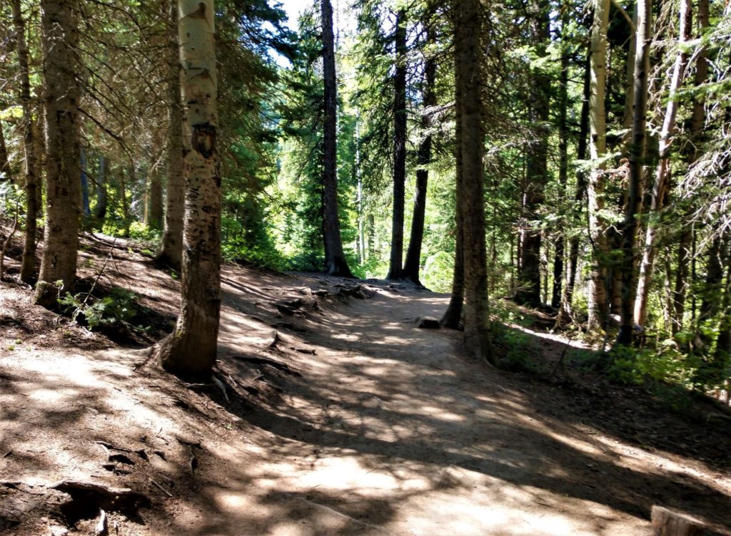
Pretty soon you get to the river that the falls run into. There is a wooden bridge to cross, and then you hike with the river on your left.

This part is really just a walk along a smooth path under the Aspen trees.

By the time you get close to the falls, the path ends and you are walking up the side of the river. For awhile you can stay on the dirt and rocks at the edge.

There are also conveniently placed logs to keep your shoes dry. I was carrying the toddler at this point, but I still managed not to fall in.

The trail comes out again on the other side of the river, so if you want to climb higher, you have to cross the river.
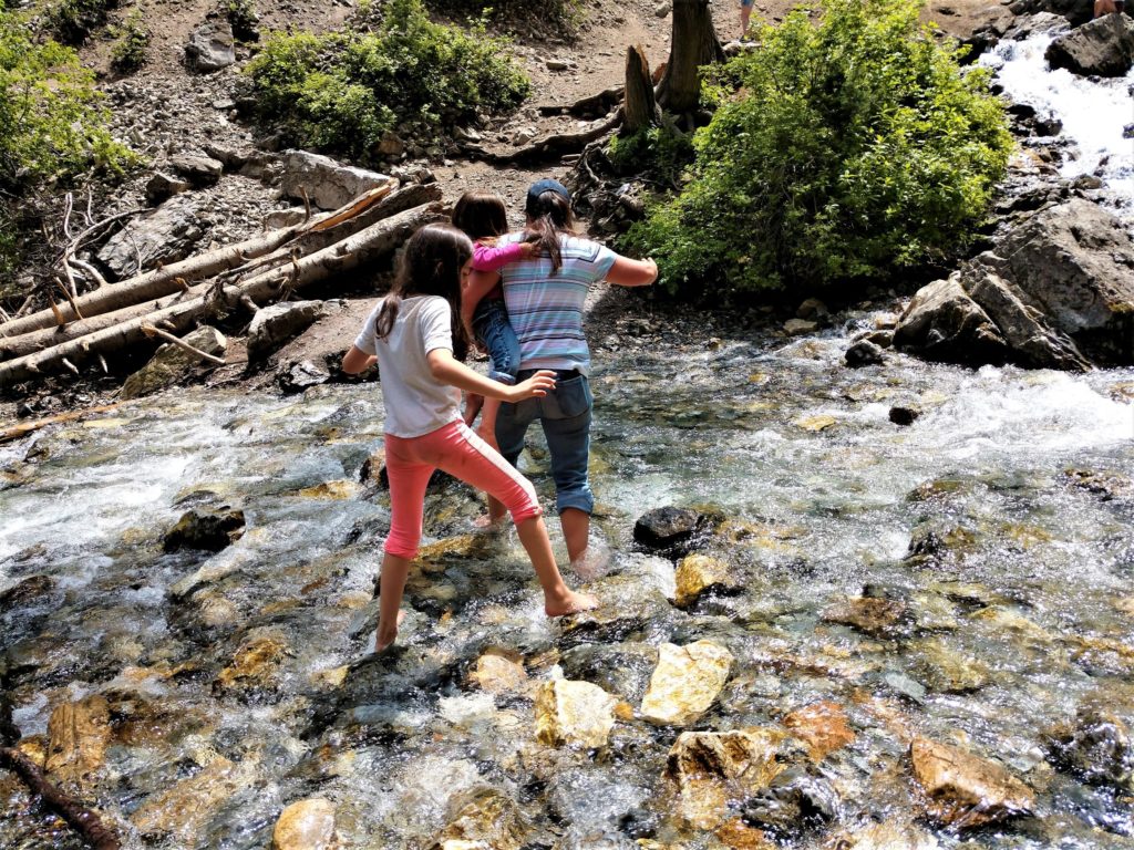
It was quite a decision at that point, but finally we opted to take off our shoes and leave them on the bank.

Once you cross the river there is a sign telling you not to proceed any further. Apparently in the past there have been a few deaths when people were climbing past the donut. The donut is way up at the top, and was formed when the water eroded the top of a cave enough to break through in one section. The water flows through the hole in the donut and splashes down into the cave before continuing down the rocks.

Because I was carrying the toddler, I did not attempt to climb past the sign. I have climbed to the donut before, and it didn’t seem treacherous, but I didn’t try to climb past the donut to get an amazing photo.

Also, this trip was in June, when the water was high. Last time I was there it was mid September, and we didn’t have to walk in the river at all. We just crossed over on a log, because it wasn’t flowing nearly this fast and wide.

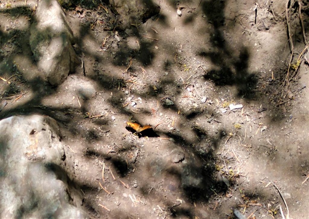
The toddler and I had fun watching butterflies while waiting for the older kids to attempt to climb the falls.
Soon we were on our way down. The entire round trip is only 1.5 miles if you park at the trailhead. (If you walk up the road it ends up to be 3.5 miles roundtrip.) The kids still had enough energy to run and skip along the trail.
If you want a fun, easy hike, that’s not very far from Salt Lake City, Donut Falls is a good one! Do you like to hike? What are some of your favorites?


17 Comments
Stacey Billingsley
What a lovely place to hike! I love your trail pictures; they really stir the imagination. Your kids are adorable. My family went to Utah for the first time this summer, but we were in the Moab area. I’m looking forward to exploring more of the state!
Lori
Thank you! Moab is a beautiful area with all of it’s slickrock. I hope you get a chance to see more of Utah soon!
Taquia
Donut Falls is beautiful! It looks like a great place to hike with family.
Pamela K Howard
What a lovely hike. The name is terrific too – I think I’d plan an early morning hike there and start out (or finish with) coffee and donuts!
Lori
What a great idea!
Tricia Snow
Wow I loved your photos. This looks like an amazing hike. I would love to try it but I would probably listen to the sign. It looks dangerous form here! lol
Lori
Thank you! It was running pretty fast this time. Last time was in the fall and there wasn’t as much water, so we felt pretty confident.
Jennifer
I’d like the part walking in amongst the trees in the shade.
Lisa Manderino
We did this hike earlier in May or June and we thought it was pretty intense. My kids were so tired by the end!
Leeanne
What a fun hike. I love that it’s not too long or tough for the kids, yet there is water involved which is always a love of ours.
Cindy
Looks like a beautiful area to hike through! I love walking near rivers and hearing the water.
melissa
This looks like a great hike! My kids would love walking along (and in) the river and exploring the rocks. The fact it’s little legs friendly is perfect as well!
Missy
Yes, we love hiking. I like this hike because it is near water. If you get hot, you can cool off.
kmf
What a beautiful trail! And love your adventurous family crossing the river. Great photos!
Chantelle
This looks like a great hike!
Cindy Mailhot
I am more of a walker than a hiker but the water looks refreshing.
Barbara
What a great hike! Looks beautiful!